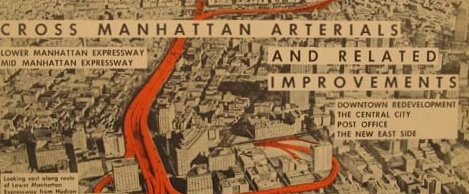
Right now there are three retrospective shows in New York about Robert Moses and his legacy. One of my all time favorite museums - The Museum of the City of New York is hosting Robert Moses and the Modern City. Columbia University's Wallach Art Gallery has Slum Clearance and Superblock Solution and the Queens Museum of Art has The Road to Recreation.
I spent some time this weekend comparing the parkway at Elmwood and Bidwell to the 33's obliteration of the Parade when we visited the Orphan Home down on Dodge Street. Wonder what Jane Jacobs (1916 - 2006) would have to say about the sort of revisionism and reconsideration of Robert Moses. Yikes...
__________________________________________________________________________
Artspace Archive • Annals of Neglect • BAVPA • Where is Perrysburg? • Broken Promises...
Writing the City • Woodlawn Row Houses • faq • my flickr
the creativity exchange
Artspace Archive • Annals of Neglect • BAVPA • Where is Perrysburg? • Broken Promises...
Writing the City • Woodlawn Row Houses • faq • my flickr
the creativity exchange


2 comments:
I never realized that the Robert Moses used to cross through the park until walking around there this fall. It blew my mind.
Along with the 198 through Delaware Park and the 33 through Humbolt Parkway we can only question what the hell people were thinking.
Parkland was already gov't held. What could be easier to run highways through than land it already owned?
Public Input, Robert Moses Parkway
Quality Inn, Niagara Falls Blvd. Niagara Falls, NY
May 9, 2007
Robert Moses, ‘the master builder,’ divided close-knit neighborhoods, demolished viable housing, relocated the poorest New Yorkers to the city’s edge and promoted flight to the suburbs. He rapidly transformed one [section] of the city [into] its poorest area. It became a dumping ground for the city’s environmental burdens. The land is overrun with power plants, waste transfer stations and toxic industry, and bisected by highways.
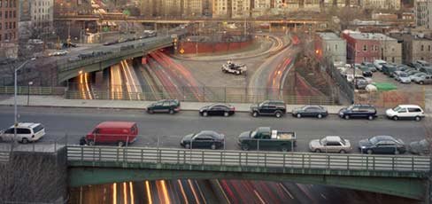
If you think I’m referring to Niagara Falls, I’m not. It’s another parallel Moses-built road story happening in the Bronx with a highway called the Sheridan Expressway.
A 2003 report found online stated the 1.25 mile Bronx segment of the Moses Sheridan Expressway is slated for reconstruction by the New York State’s DOT, but the [Bronx] locals are fighting back with a plan of their own.
It includes removing the highway altogether in the name of urban revitalization. Few vehicles use the Bronx Sheridan and it’s generally considered redundant.
The Bronx “Community Plan” would use the highway for open space as part of the Bronx River Greenway, a bike/pedestrian pathway and park planned for the entire 23-mile length of the Bronx River.
Sound familiar?
The Bronx plan started in 1998—and just like the 1997 Niagara Heritage Partnership plan to remove all four lanes of the Robert Moses Parkway between Niagara Falls and Lewiston--is part of a growing list of communities worldwide removing roads in favor of riverfront open space and water front access. This partial list includes the cities of San Francisco, Portland, Seattle, Toronto, and Seoul, Korea. These examples prove that road removal is viable in urban areas. The Bronx plan--just like the Niagara Heritage Partnership’s plan --is part of a local, state, national and international movement. Planners globally are rectifying transportation mistakes.
Joan Byron of the Pratt Institute, a member of the South Bronx River Watershed Alliance, said, “If the [citizen advocated] alternatives seem radical, it’s because for 50 years, we have allowed highway engineers to be the primary shapers of huge parts of our cities, and allowed the movement of vehicles to trump all other considerations of urban design, public health and safety, and environmental quality.”
Source: www.gothamgazette.com 18 Aug. 2003)
Seventy case studies from 11 countries and the opinions of over 200 transport professionals world-wide disprove the statements that displaced traffic will simply divert to neighboring streets, clogging them, and leading to worse traffic problems.
In summary, the studies found that “well-designed and well-implemented schemes to reallocate road space improves conditions for pedestrians and cyclists without increasing congestion or other related problems. Ironically, [one newspaper’s] predications of disaster may have been effective in preventing problems from actually occurring.”
The studies listed benefits: air-quality improvements, reduced neighborhood severance, increased business investment, more attractive living and working conditions, and improved retail vitality.
The potential opportunities achieved are traffic reduction, urban regeneration, more efficient use of economic [and scenic] resources and other national policy objectives.
Source: Roadspace Reallocations Schemes, Institution of Civil Engineers, London, England, 06/12/2001.
The benefits, the rationale, the positive outcome from total removal of all four lanes of the Robert Moses Parkway are documented and proven beneficial. Why did they leave it out of the Niagara River Greenway? Which politicians obstructed?
For more info: www.niagaraheritge.org
Post a Comment